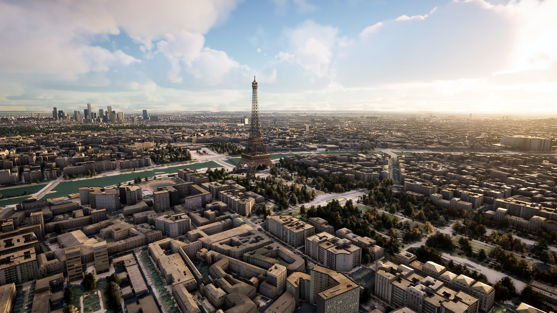
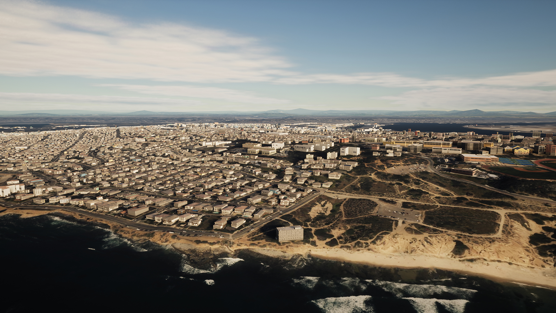
SYNTH3D is a realistic 3D replica of the surface of our planet including a terrain model, terrain texture, buildings and vegetation. The realistic replica is perfectly suited for any geospatial training, simulation or visualization application. Every country, area, city and building is included in a region-specific, geotypical way and is ready to elevate your applications. Developed through a partnership between Maxar and blackshark.ai, SYNTH3D provides a high-performance, geotypical representation of the entire planet for professional metaverse applications.
Digital Twin of Earth
Features and benefits
- Fast and automated content delivery of any large-scale area
- Global coverage and automated updates derived from recently collected satellite imagery
- Unprecedented, authentic level of visual fidelity and object detail
- Geospatial standard formats allow instant usage in existing applications
- Extensive framework for technical deep data integration
Industries and use cases
- Industrial metaverse
- Commercial metaverse
- Security, defense and safety
- Architecture and construction
- Infrastructure, energy and utility
- Gaming, entertainment and media
- Smart city and IoT-data visualization
- Training of autonomous systems
- Flight simulation, eVTLOs and UAVs
SYNTH3D data layers
- 1.4 bilion building footprints
- Buildings in regional-specific architecture
- 30 milion sq km vegetation coverage
- 30 m global digital terrain model
- 50 cm GSD ground texture (Maxar’s Vivid imagery basemap)
- Semantic metadata and material attributes
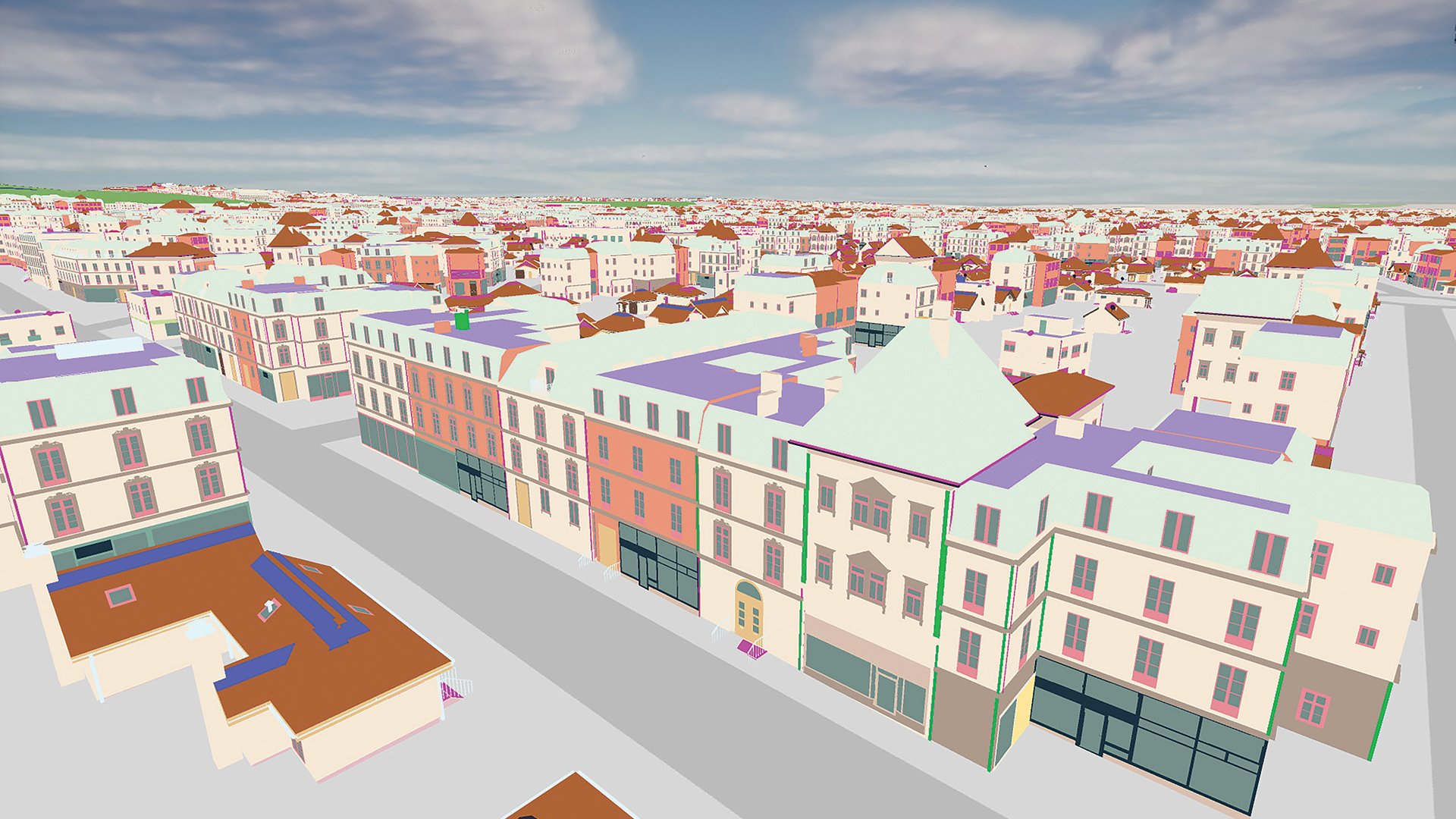
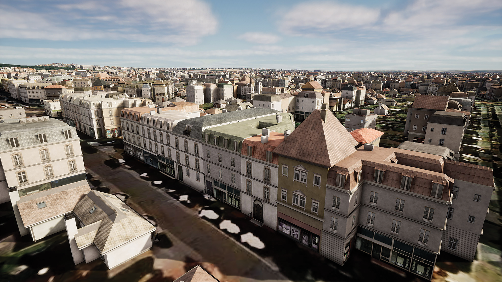
Detected buildings
SYNTH3D contains the most current building vector database and vegetation coverage map, including semantic meta-data, extracted with patented artificial intelligence (AI) technology from Maxar’s Vivid satellite imagery basemaps,
a cloud-free, virtually seamless view of Earth, with rich natural color and precise visual clarity.
Region-specific architecture
blackshark.ai’s patented generative AI turns detected buildings into lifelike models, assigning regionally appropriate building architecture and facades, with realistic textures. Specific buildings may look different in the real world, but the overall appearance of every region and city reflects reality.
Ready for physical simulation
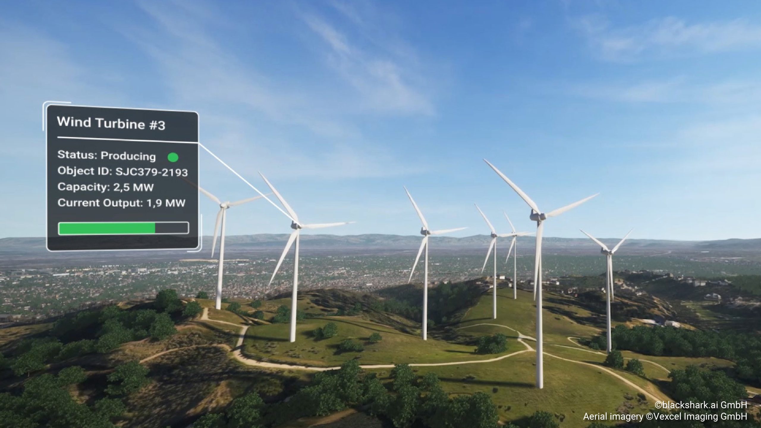
Semantic information, metadata and material attributes for all objects are embedded in SYNTH3D – making it ready for physical simulation applications.
Formats and integration
3D file formats
- USD, FBX, OBJ, glTF
- blackshark.ai software development kit (SDK)
- Plugin for Unreal Engine
2.5D file formats
- geoPKG
- ESRI Shapefile
Are you interested to try?
blackshark.ai for Unreal Engine
The Blackshark.ai Globe Plugin for Unreal is for free and is streaming in blackshark.ai SYNTH3D data and unfolds it to highly realistic, performant 3D environments on the client device. It enables everyone to easily combine it with other Unreal Engine plugins or with your own 3D assets, data layers and to build geospatial applications with it. The plugin includes many useful functionalities and provides access to data points and handles.
Explore more
Functionality overview
- Streaming of terrain elevation model and terrain texture tiles in different LODs
- Streaming of SYNTH3D building data and vegetation coverage
- New Orleans SYNTH3D sample data included (2,5 x 2,5 km)
- 3D reconstruction and rendering of the entire 3D environment at runtime
- Easy conflation or replacement with own data layers or 3D building models
- WGS84 referenced the globe system
blackshark.ai for NVIDIA Omniverse
SYNTH3D can easily be used within nvidia Omniverse and other 3D simulation environments in the USD file format. The SYNTH3D as USD exports still contains all information about 3D buildings, vegetation, and terrain data in various levels of details.
Explore more
blackshark.ai Globe SDK
The native blackshark.ai Globe SDK (software development kit) provides an extensive development environment to deeply integrate and control SYNTH3D data and to build exciting high-performance applications.
Request Access
Functionality overview
- Outstanding visual quality
- Combine with additional 3D models
- Integrate geospatial data layers
- Easily handle metadata and attributes
- Use of navigation and collision mesh
- Deep data integration via APIs